Adventures while walking about Auburn, Alabama and its environs...
[ABOUT] - [MAP] - [LINKS] - [EMAIL]
Notasulga
It has been a while since I walked 20 or more miles (what I consider a "long" walk), but the weather has cooled down from summer, and I was able to coordinate a carpool with a friend who was driving down to Montgomery in the morning. He was kind enough to drop me off at Exit 38 on I-85 in Tuskegee. This allowed me to start far enough away from my house that I actually trekked along roadways I'd never walked upon before.The first 6 miles were north up state highway AL-81, at which point I got to Notasulga, Alabama (and roads I had traversed in the past).
There's not much to see in rural Macon County, but that's kind of the point to all of this walking... to enjoy the nothingness that is out there. I did snap a few pictures of some interesting buildings and signs:
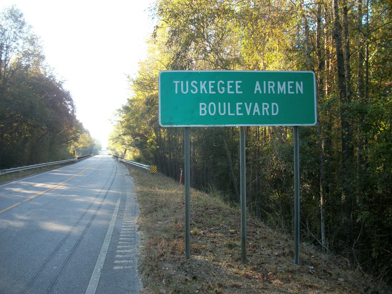
Like I said, I started in Tuskegee:
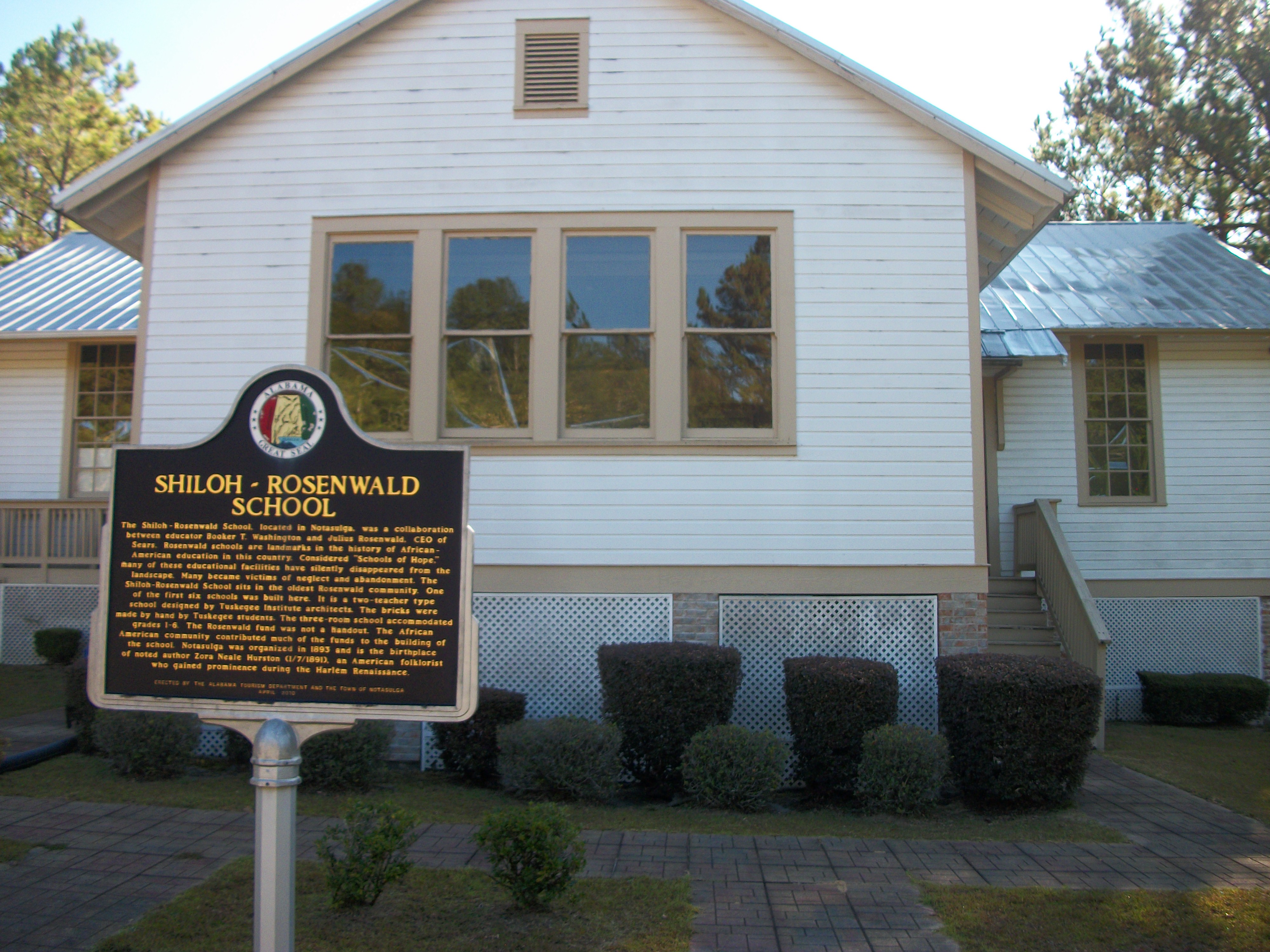
I think I've seen another of these school placards in Loachapoka:
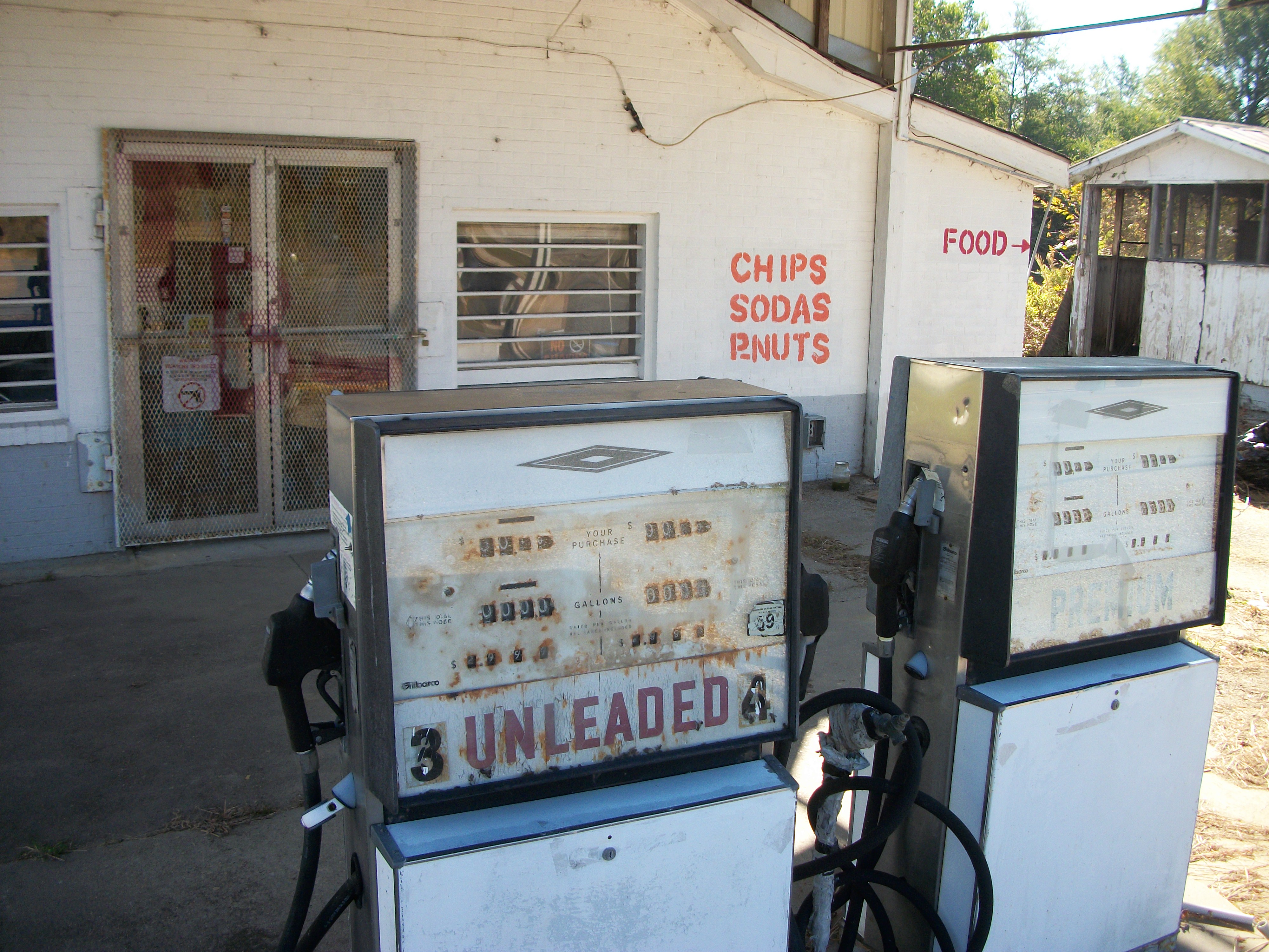
This place was no longer open for business, but I loved the old gas pumps:
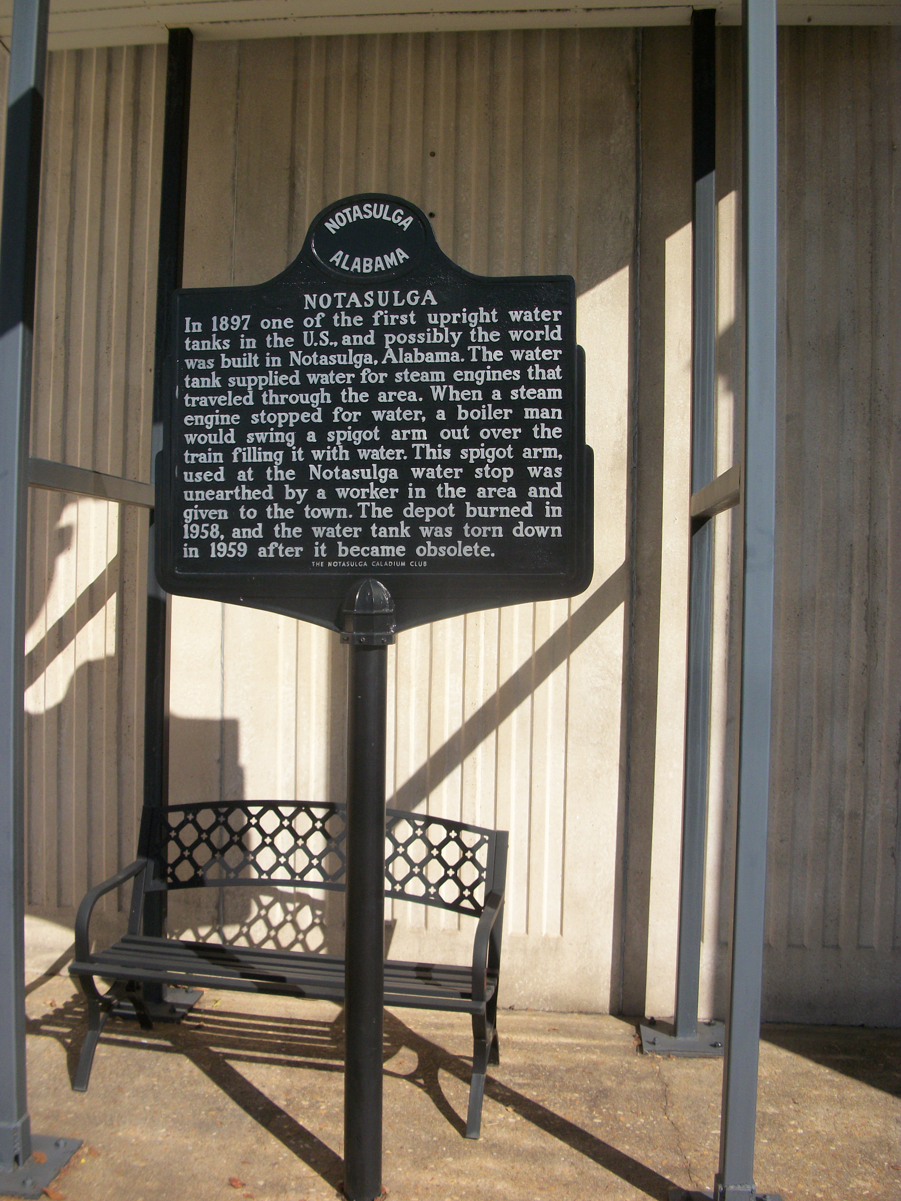
This is in the center of Notasulga:
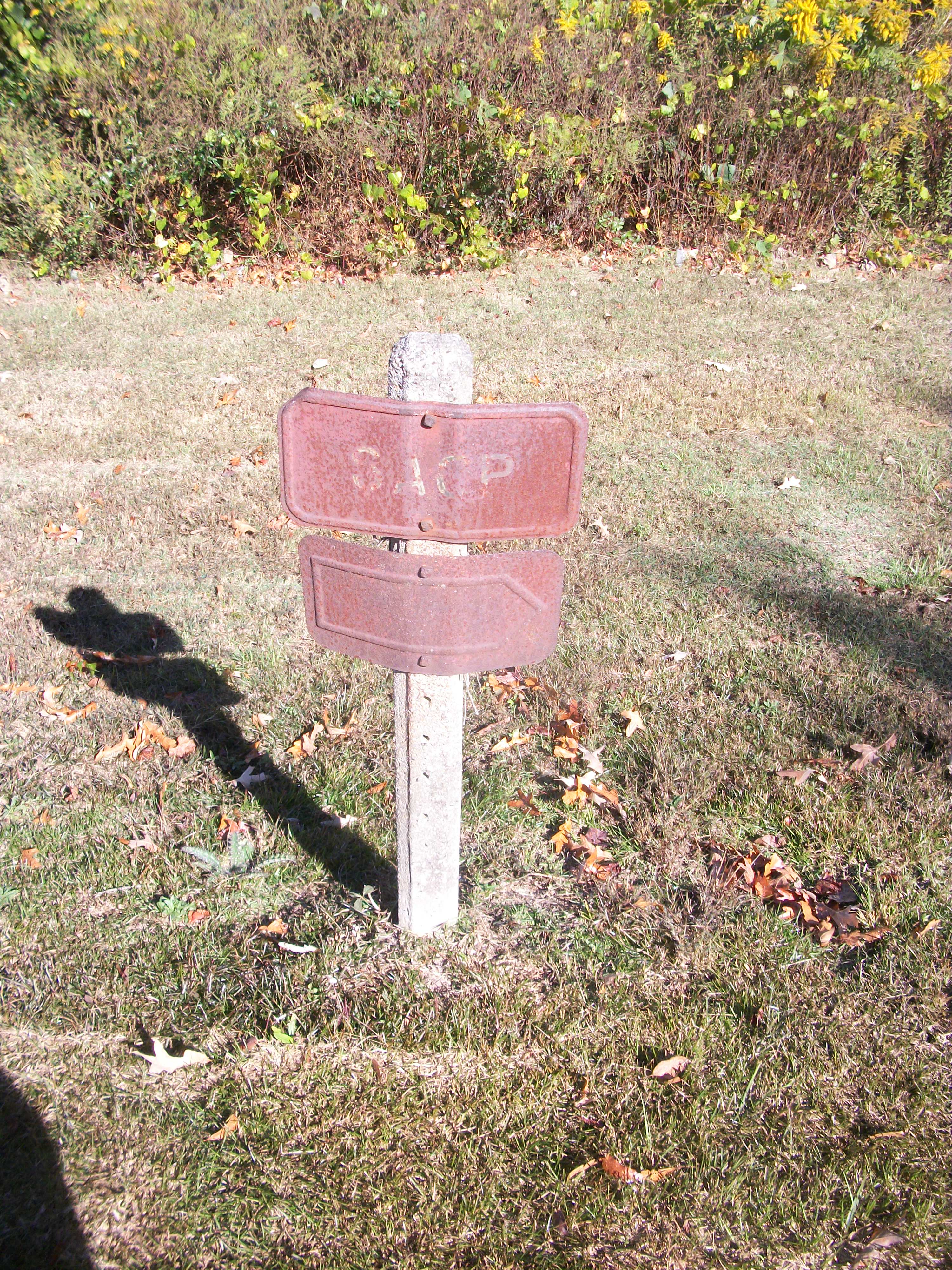
I discovered another one of these signs in Notasulga (right across the street from the high school), but it was so rusted, I could not read the numeral designation.
Article Topics:
notasulga
ruins
schools
tuskegee_national_forest
2025 [3]
2024 [5]
2023 [8]
2022 [4]
· OCTOBER [1]
| 20th | Notasulga |
· SEPTEMBER [1]
· JULY [1]
· JUNE [1]
2021 [9]
2020 [13]
2019 [26]
2018 [1]
2017 [1]
2016 [3]
2015 [1]
Topics
· animals
· auburn_university
· bridges
· camp_hill
· cemeteries
· chewacla_state_park
· churches
· creeks
· foraging
· libraries
· little_texas
· loachapoka
· maps
· milling_about
· notasulga
· puzzle_parties
· roads_scholar
· roxana
· ruins
· saugahatchee_road
· schools
· signposts
· springvilla
· stage_road
· trains
· tuskegee_national_forest
· underground
· unpaved_roads
· weather
Offbeat Auburn website, Copyright © 2015 - 2025, Eric Harshbarger