Adventures while walking about Auburn, Alabama and its environs...
[ABOUT] - [MAP] - [LINKS] - [EMAIL]
Bonny Glen Road
Today I explored what may be the City of Auburn's longest remaining unpaved road (I've documented unpaved city roads several times in the past). Whether or not it is actually the longest named, undeveloped road, it is certainly my current favorite street within the city limits. But really, "street" seems to be vastly overstating its status. This seems to be an old county road that got incorporated into the city limits, named "Bonny Glen Road", and then promptly forgotten about (it branches off Hamilton Road a hundred yards or so away from the site of an abandoned hovel I documented on this blog at the beginning of 2020).There are a dozen or so residences on Bonny Glen, so it's not like it's just a path through pasture land. But, it really seems like a secluded area that has managed to escape the hustle and bustle of the growth of Auburn during the past generation. Walking down the half mile or so, it felt like I was in the middle of undeveloped county land.
That said, there are now fairly recent neighborhoods built in the immediate area, and just on the north side of Moores Mill Creek (were Bonny Glen finally comes to a dead end), brand new paved roads are being put down for a future subdivision.
How long will it be until Bonny Glen finally succumbs to asphalt pavement? Will the old abandoned bridge across the creek be renewed and the new neighborhood roads connect with this forgotten place?
Who knows, but I'm glad I discovered this area before any of those changes occur.
Below is a series of videos I took this morning as I walked Bonny Glen Road for the first time (you can definitely detect the awe in my voice as I'm reveling in the offbeat exploration).
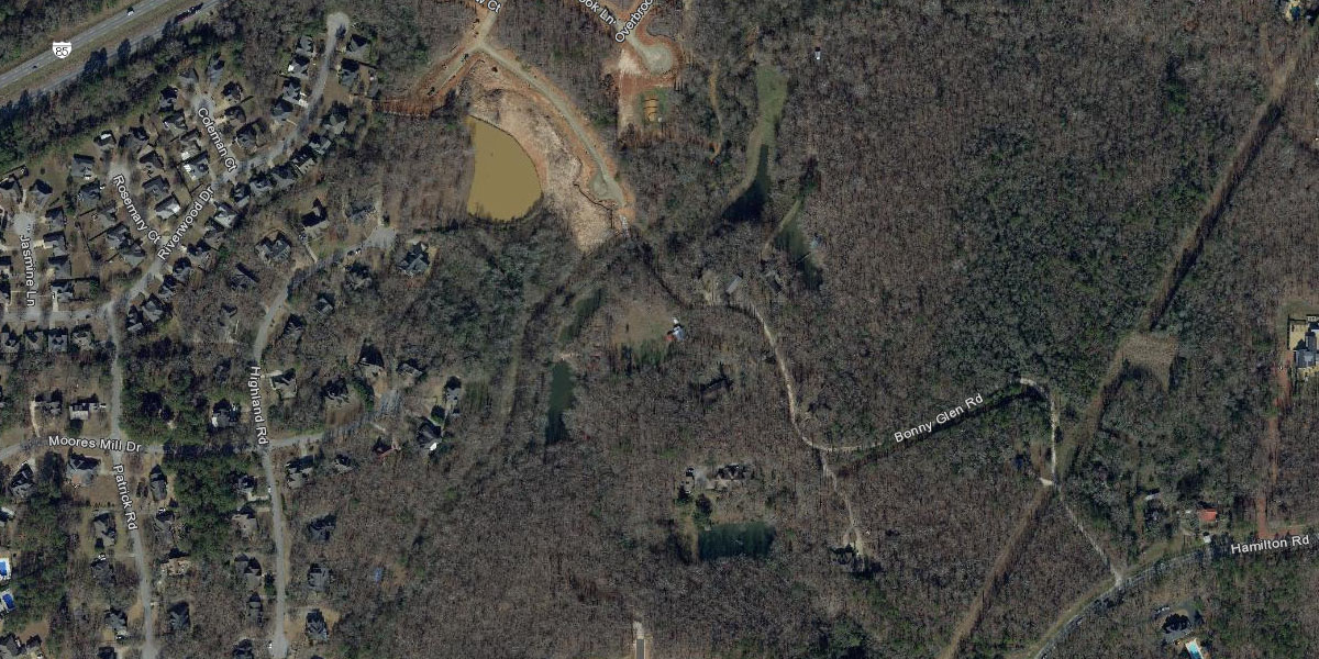
Next is a collection of aerial photos of this Bonny Glen Road area from the City of Auburn website. These pictures span over 50 years and show that not only has the road existed that whole time (as a county road long before Auburn neighborhood crept up around it), but it has also changed its connectivity to other streets...
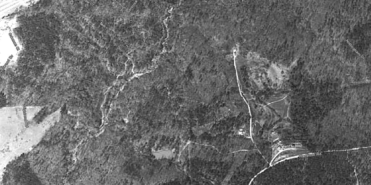
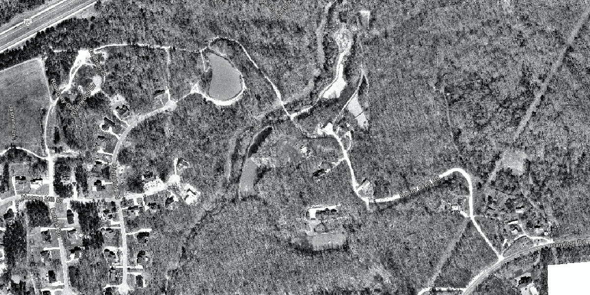
1966
In the southeast corner of this picture you can see a road branch to the north off of what was then County Road 16 (I believe). CR16 would eventually become Hamilton Road, and that branch would change course and eventually be named Bonny Glen Road by the City of Auburn.
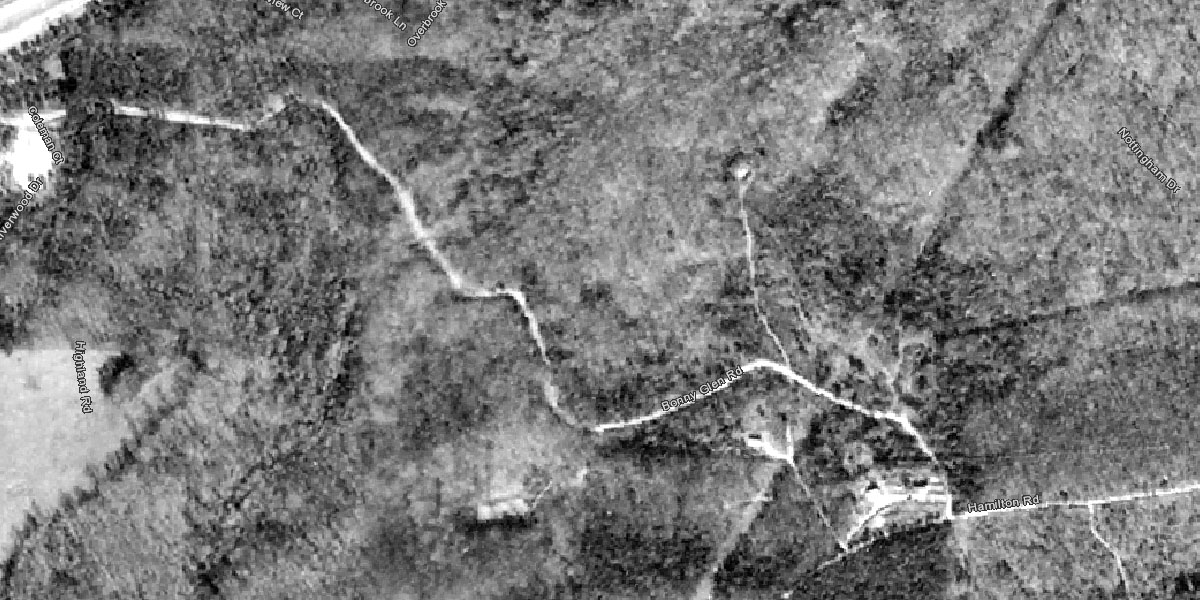
1973
Now the dirt road travels north-westward and ends at some undeveloped land next to the interstate (I-85). The road, though unpaved, is clearly visible and seems quite used.
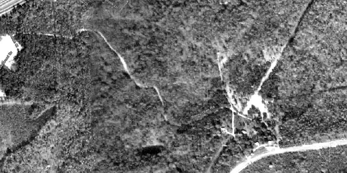
1980
In 1980, the land around the road seems more wooded (possibly just a different time of year for the photograph). The road seems to be in the same condition.
1986
Notice that a few residences and dirt driveways have popped up right in the middle of the picture, around a couple of new ponds.
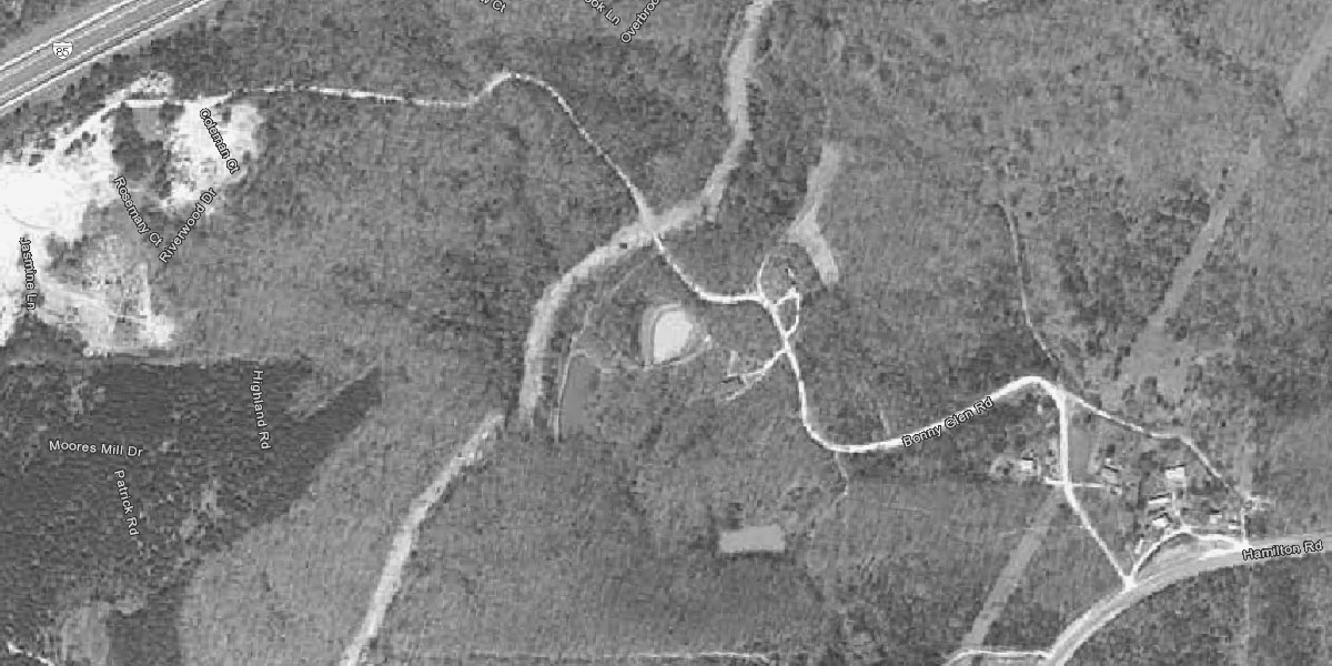
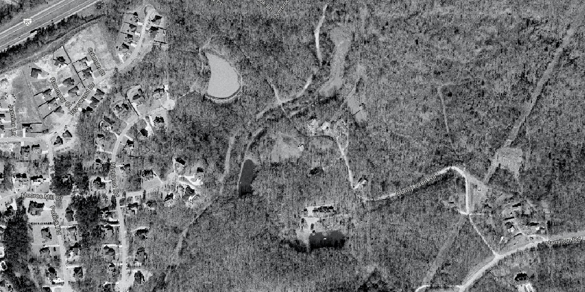
1997
By 1997 a new large lake is present, and the Moores Mill Drive neighborhoods have encroached from the west. I believe (having checked old road maps) the road itself is still on county land (not incorporated into the city) at this point.
2002
Over the next fifteen years or so you can see that, as the neighborhood in the northwest developed further, the road actually disconnects from the streets of that neighborhood. By 2017 (below) the road seems to have retreated to Moores Mill creek (which is running diagonally through the middle of all of these pictures).
2011
2014
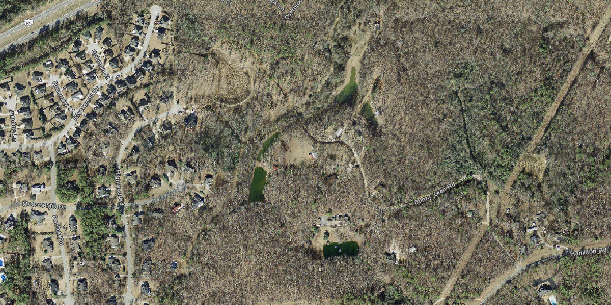
2017
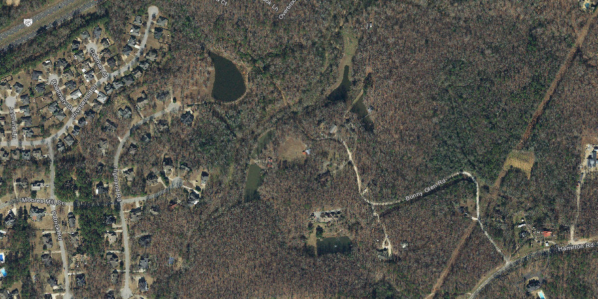
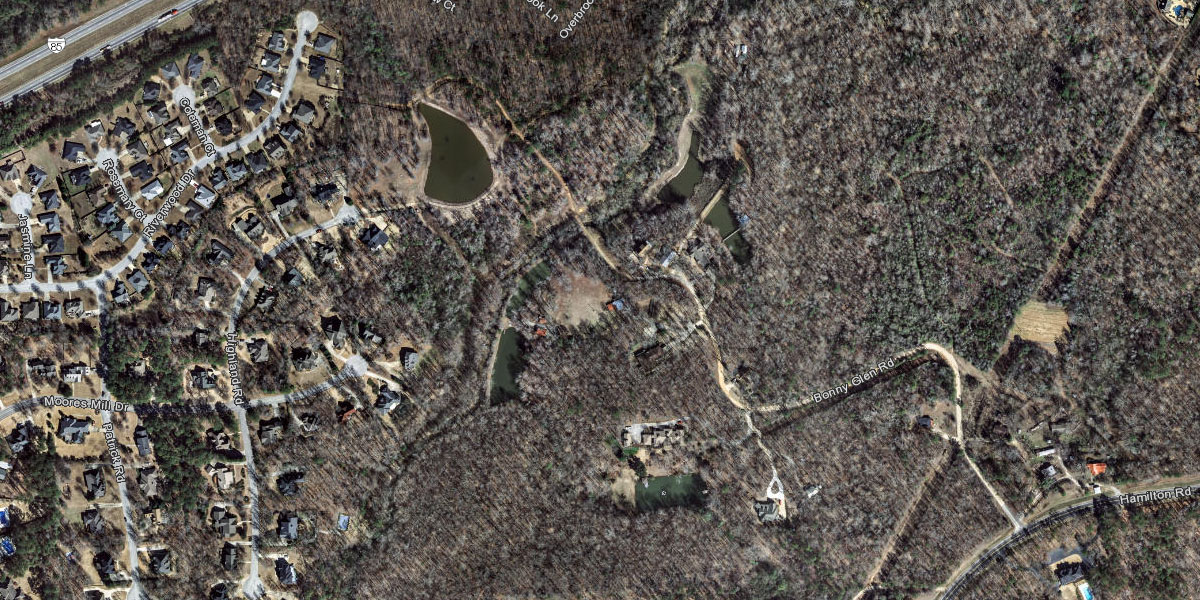
2020
By the time I'm writing this article one can see that a new neighborhood is about to be developed (upper center of photo), and one of its roads leads right to Bonny Glen's bridge over the creek. This is the area I walked to when taking the video above. If (if) Bonny Glen is re-opened (there is a gate blocking the old bridge across the creek now), it will end up connecting to a road that leads eastward (Champions Boulevard, which hits Bent Creek Road just south of the interstate). There is still walking access to Riverwood Road in the neighborhood to the northwest, but the way is not driveable as the point of disconnection is covered with lawn grass for about 100 yards (though it still seems to be city right-of-way land, between to houses on private property).
Article Topics:
creeks
milling_about
roads_scholar
unpaved_roads
2025 [3]
2024 [5]
2023 [8]
2022 [4]
2021 [9]
2020 [13]
· DECEMBER [1]
· OCTOBER [2]
· SEPTEMBER [3]
| 19th | Camp Hill Adventure |
| 6th | Tuskegee National Forest |
| 1st | Bonny Glen Road |
· JULY [1]
· MAY [2]
· MARCH [1]
· FEBRUARY [2]
· JANUARY [1]
2019 [26]
2018 [1]
2017 [1]
2016 [3]
2015 [1]
Topics
· animals
· auburn_university
· bridges
· camp_hill
· cemeteries
· chewacla_state_park
· churches
· creeks
· foraging
· libraries
· little_texas
· loachapoka
· maps
· milling_about
· notasulga
· puzzle_parties
· roads_scholar
· roxana
· ruins
· saugahatchee_road
· schools
· signposts
· springvilla
· stage_road
· trains
· tuskegee_national_forest
· underground
· unpaved_roads
· weather
Offbeat Auburn website, Copyright © 2015 - 2025, Eric Harshbarger