Adventures while walking about Auburn, Alabama and its environs...
[ABOUT] - [MAP] - [LINKS] - [EMAIL]
End of the Road?
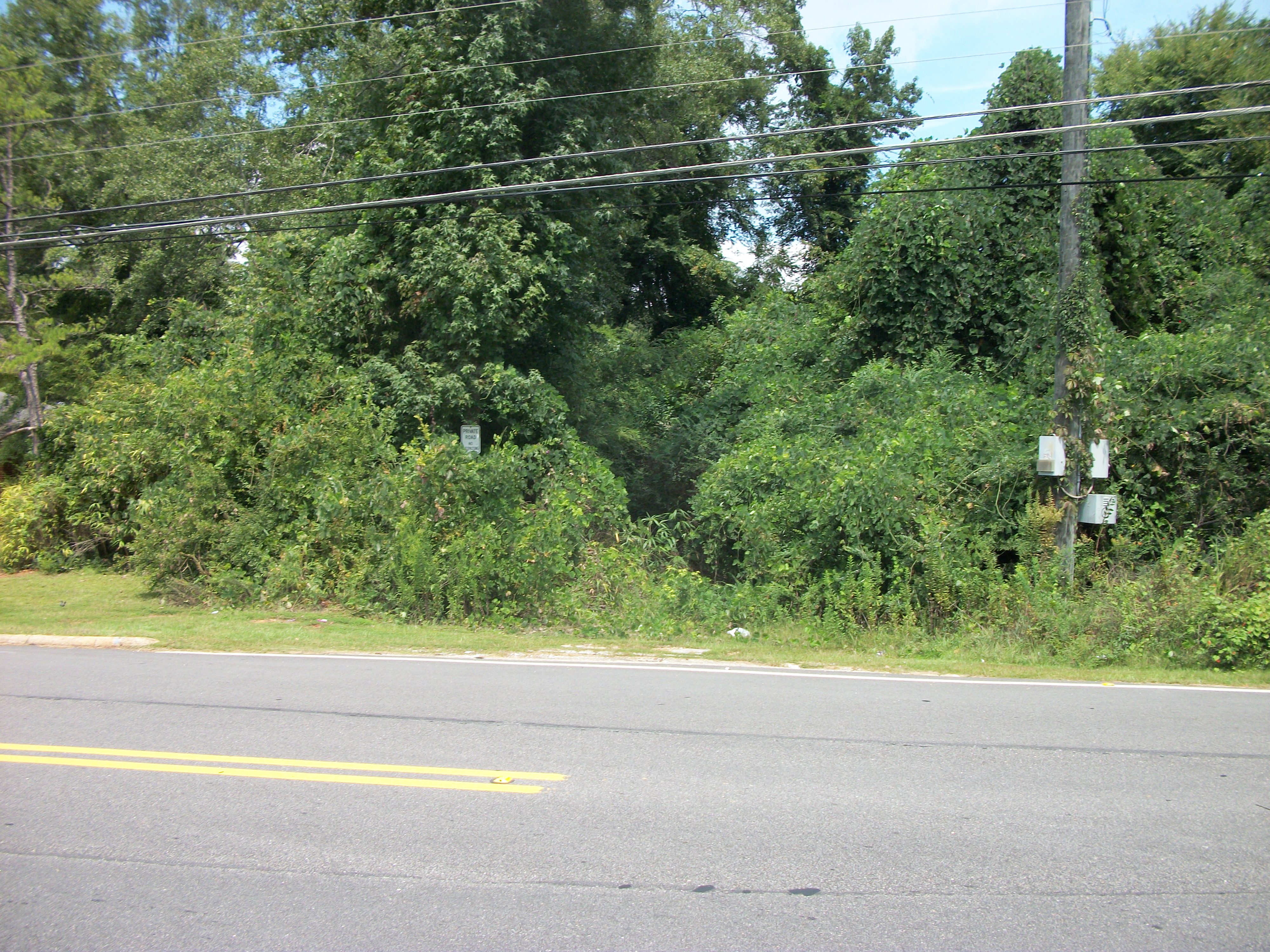
Here's more talk about an "abandoned road" within the city limits of Auburn.
As I mention in the video above, here is a clearer picture of the "Private Road" sign, taken almost exactly four years ago (1 September 2014):
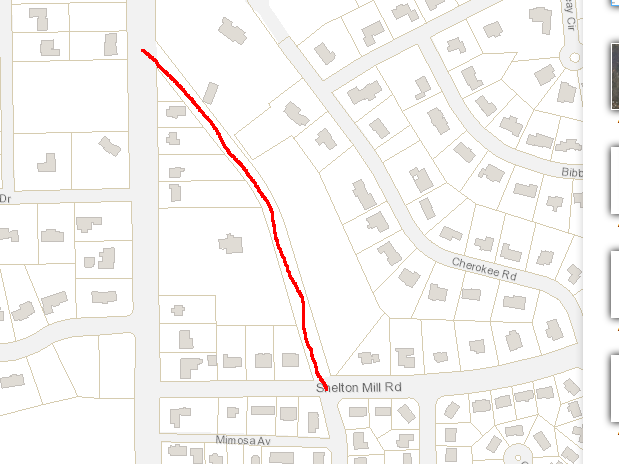
However, there may be more to this story. Below is a extract from current City of Auburn maps. The property lines on this map seem to clearly show that the area where this road once ran is not part of adjacent private properties (these property lines mimic what is also seen on up-to-date county plats).
So, who knows?
This could be a case where the city ceded rights to the land to adjacent property owners (as happened at Chisholm Drive years ago). Given that one of those property owners is the Pick family (a prominent, historic family in Auburn), it's very possible that the city quit maintenance on the old road and gave up the land.
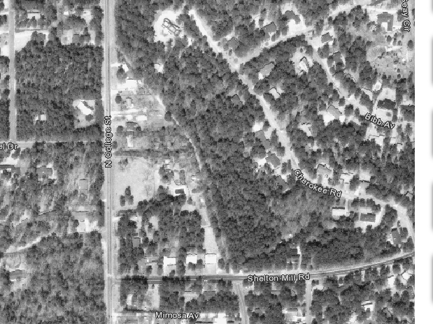
An aerial photograph of the same spot from 1986 clearly shows that the road (probably unpaved) did, in fact, eventually intersect with North College Street.
Article Topics:
roads_scholar
unpaved_roads
2025 [3]
2024 [5]
2023 [8]
2022 [4]
2021 [9]
2020 [13]
2019 [26]
· DECEMBER [1]
· OCTOBER [2]
· SEPTEMBER [2]
· AUGUST [3]
| 25th | End of the Road? |
| 24th | Sherwood Drive |
| 17th | On The Boulevard |
· JULY [2]
· JUNE [1]
· MAY [2]
· APRIL [2]
· MARCH [4]
· FEBRUARY [6]
· JANUARY [1]
2018 [1]
2017 [1]
2016 [3]
2015 [1]
Topics
· animals
· auburn_university
· bridges
· camp_hill
· cemeteries
· chewacla_state_park
· churches
· creeks
· foraging
· libraries
· little_texas
· loachapoka
· maps
· milling_about
· notasulga
· puzzle_parties
· roads_scholar
· roxana
· ruins
· saugahatchee_road
· schools
· signposts
· springvilla
· stage_road
· trains
· tuskegee_national_forest
· underground
· unpaved_roads
· weather
Offbeat Auburn website, Copyright © 2015 - 2025, Eric Harshbarger