Adventures while walking about Auburn, Alabama and its environs...
[ABOUT] - [MAP] - [LINKS] - [EMAIL]
Tornado!
On 3 March 2019 a major tornado (possibly multiple tornadoes) passed through southern Lee County. As I write this at least 23 people have been reported killed by the storms and thousands of people are still without power.I am intimately familiar with the rural area affected by this storm; my parents live about a mile away from where the majority of the damage was sustained. As I read about all of the road closures, I recognize every one of the County Road number designations; I have walked those roads more times than I can count. From the reports I've read so far, it sounds like the worst damage was done in the red highlighted area in this map:
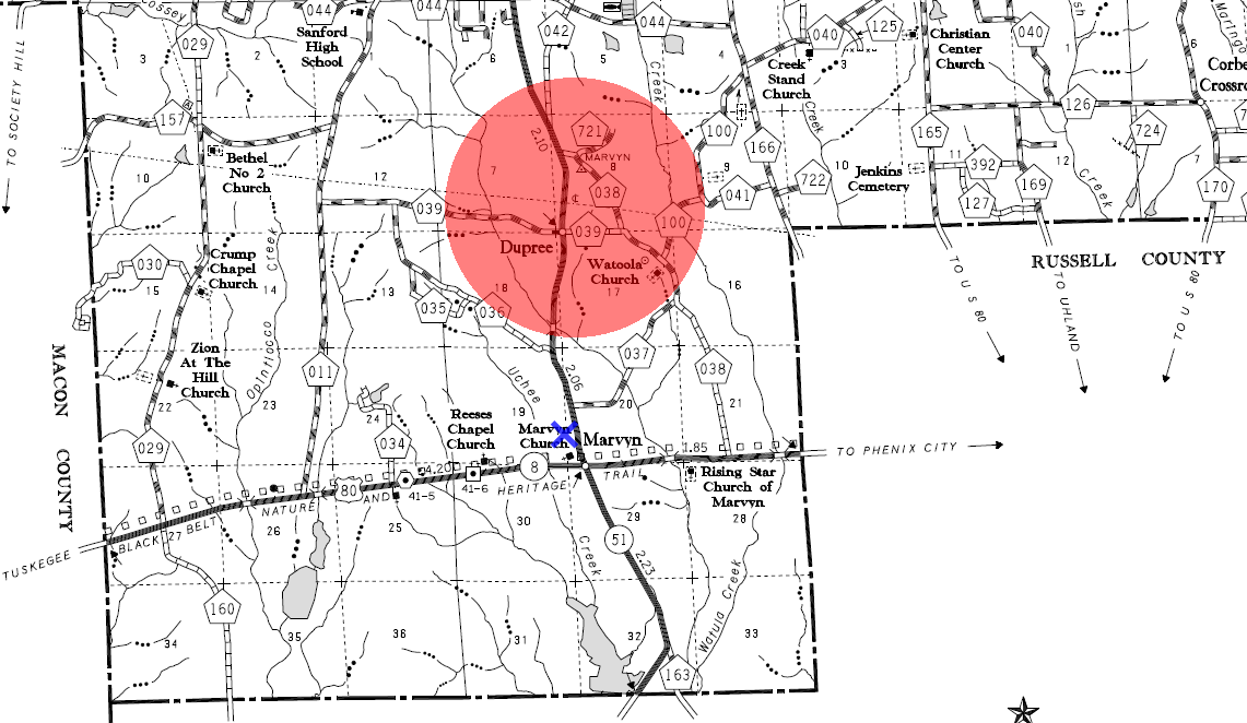
(My parents' home and acreage is marked at the blue X).
I expect to visit their place tomorrow (driving out there, not walking).
Article Topics:
weather
2025 [3]
2024 [5]
2023 [8]
2022 [4]
2021 [9]
2020 [13]
2019 [26]
· DECEMBER [1]
· OCTOBER [2]
· SEPTEMBER [2]
· AUGUST [3]
· JULY [2]
· JUNE [1]
· MAY [2]
· APRIL [2]
· MARCH [4]
| 30th | Chewacla State Park |
| 26th | Culs-de-sac |
| 19th | Zippy Marts (1) |
| 4th | Tornado! |
· FEBRUARY [6]
· JANUARY [1]
2018 [1]
2017 [1]
2016 [3]
2015 [1]
Topics
· animals
· auburn_university
· bridges
· camp_hill
· cemeteries
· chewacla_state_park
· churches
· creeks
· foraging
· libraries
· little_texas
· loachapoka
· maps
· milling_about
· notasulga
· puzzle_parties
· roads_scholar
· roxana
· ruins
· saugahatchee_road
· schools
· signposts
· springvilla
· stage_road
· trains
· tuskegee_national_forest
· underground
· unpaved_roads
· weather
Offbeat Auburn website, Copyright © 2015 - 2025, Eric Harshbarger