Adventures while walking about Auburn, Alabama and its environs...
[ABOUT] - [MAP] - [LINKS] - [EMAIL]
75 Years Later
There's a lot of talk about how much the city of Auburn is growing these days. And it's not imagined. Not only does the local University continue to grow, but all of Auburn, neighboring Opelika, and the county as a whole are booming. Consider this old city map I found at the University of Alabama's website of Historical maps:
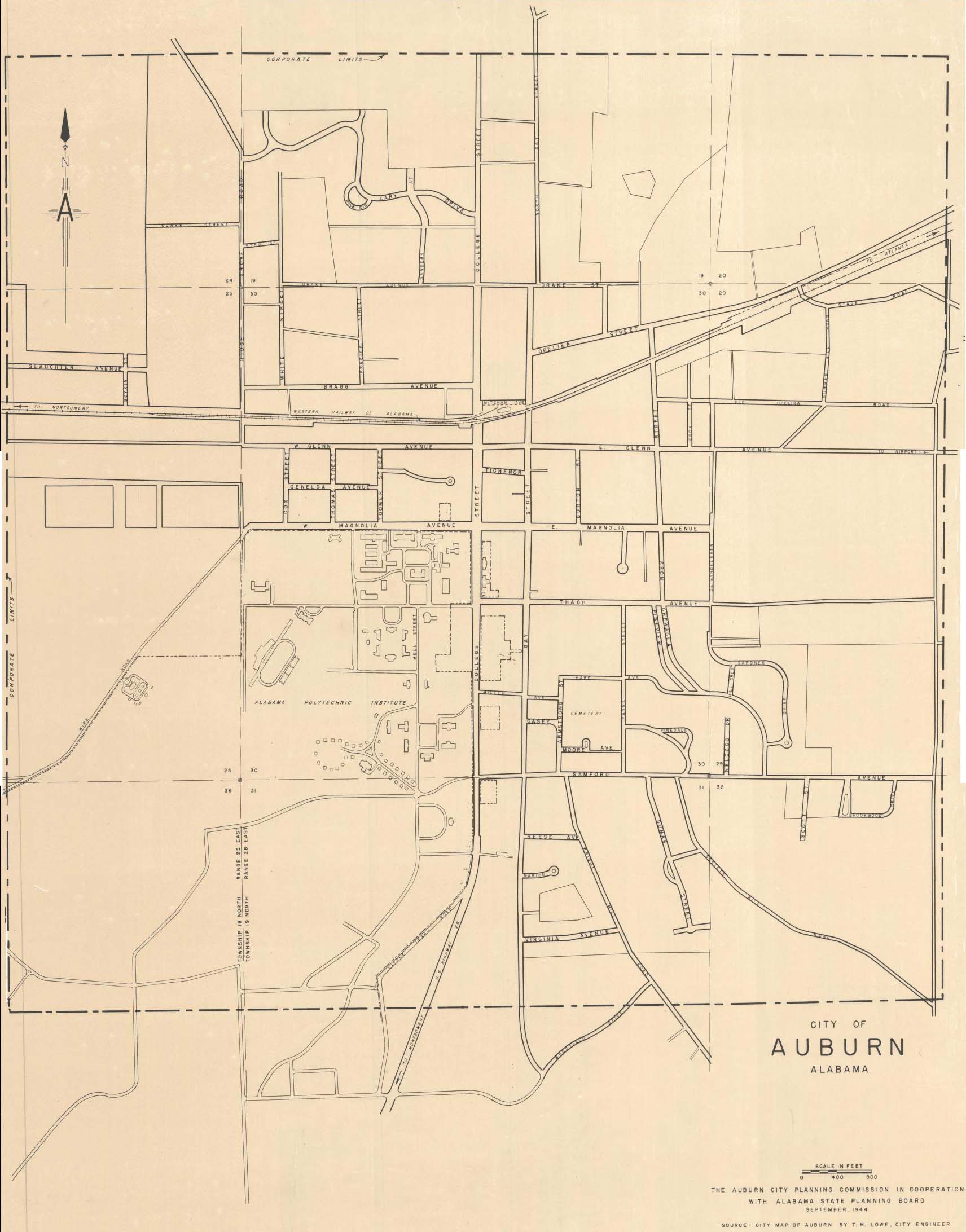
That's an official street map of Auburn from 1944. The "corporate limits" are designated by the bounding rectangular, dotted-line box around the edges. If that area is overlaid onto a more modern city map, you get this:
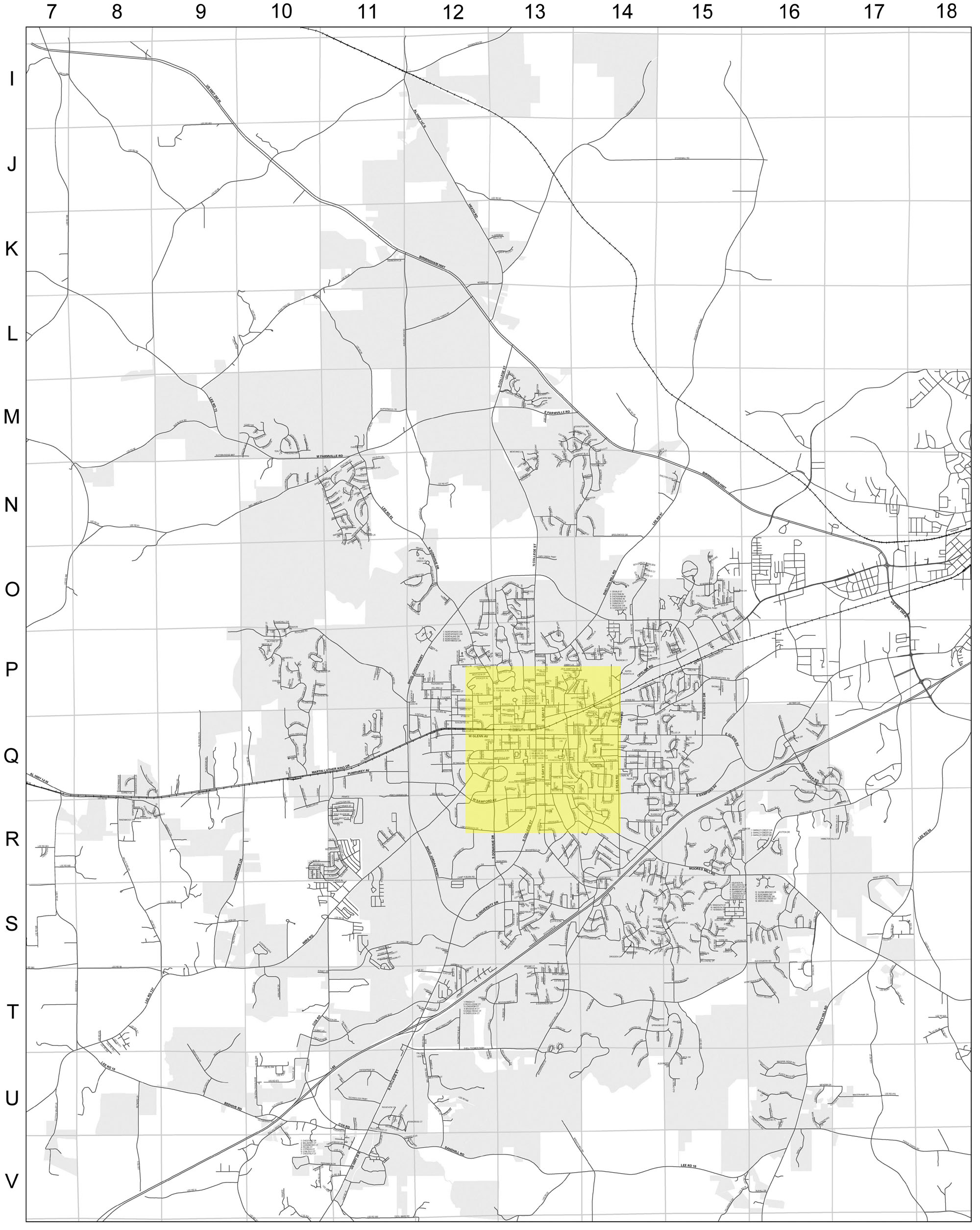
These days streets of Auburn extend north past U.S. Hwy 280, up to the community of Gold Hill; westward almost to Loachapoka; and far south and east into the rural county.
But growth aside, I'm quite fascinated by that 1944 street map above for its peculiarities in street names. Examples:
- Debardeleben Street is written as "De Bardeleben."
- There's a "Little Texas Road" that branches off South College Street. That road no longer exists (the Davis Arboretum is there now, I think?)
- Present day Donahue Drive is labeled "Ridge Grove Road" (and I've seen the "Ridge Grove" community labeled as such on modern maps... up near the Farmville area).
- Present day Harper Avenue is named "Old Opelika Road" on the map.
- Present day West Chewacla Avenue is label "Pineview."
That seventy-five year old map is filled with such changes; a reader familiar with contemporary Auburn will surely find more quirks.
The last such item listed above ("Pineview") is of particular interest to me because that road is very close to where I live these days. Evidently, decades ago, Have Avenue extended off Payne Street and connected with Pineview and Chewacla drives. That has not been the case for some time now. It's hard to tell from aerial photographs (see City of Auburn interactive maps), but those roads do not seem to connect as far back as 1966. Oddly, though, Lee County plat maps do show that those three roads still meet.
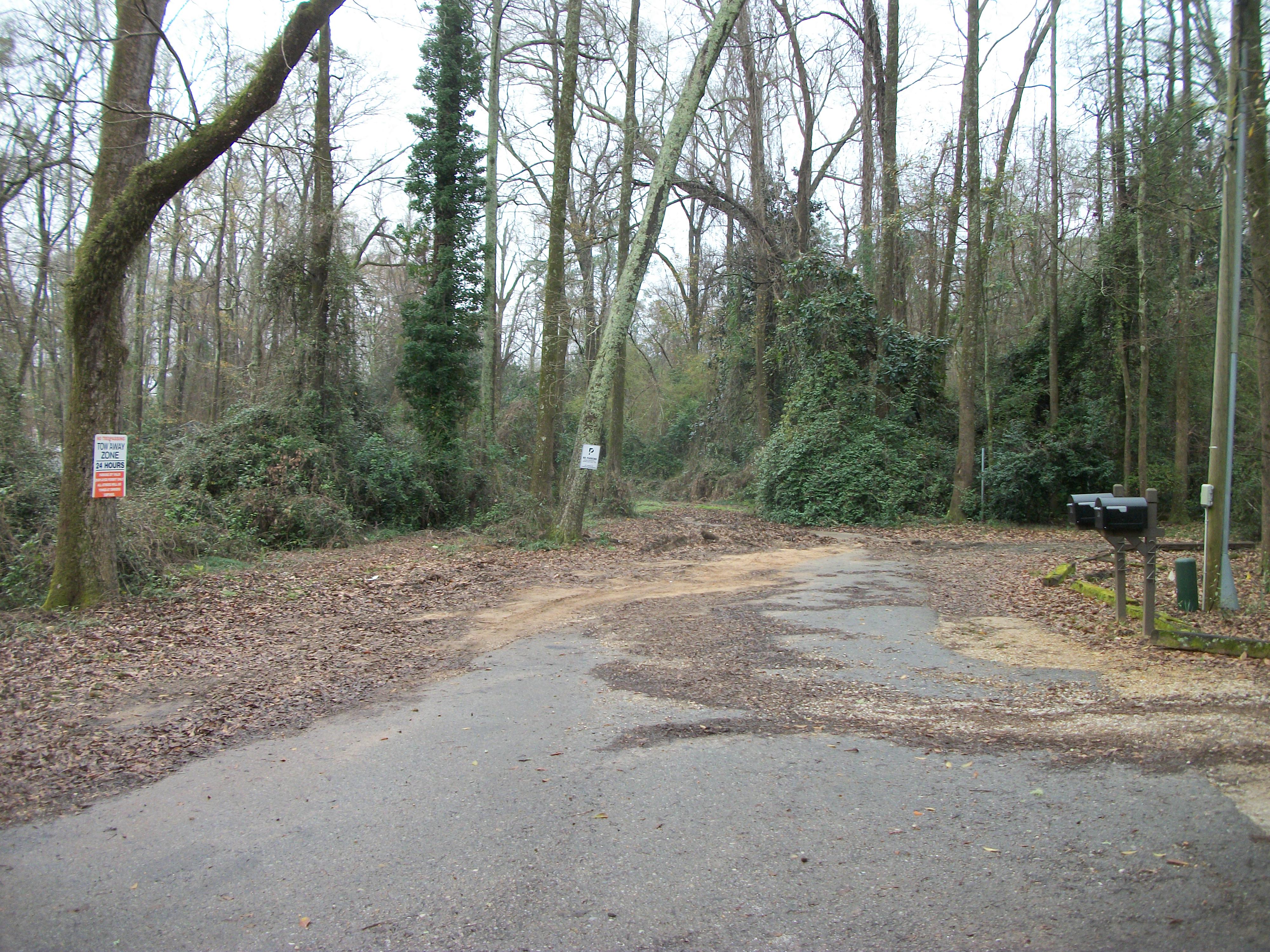
But, believe me, they do not conjoin. Here is the eastern dead end of Hare Avenue as it stands today:
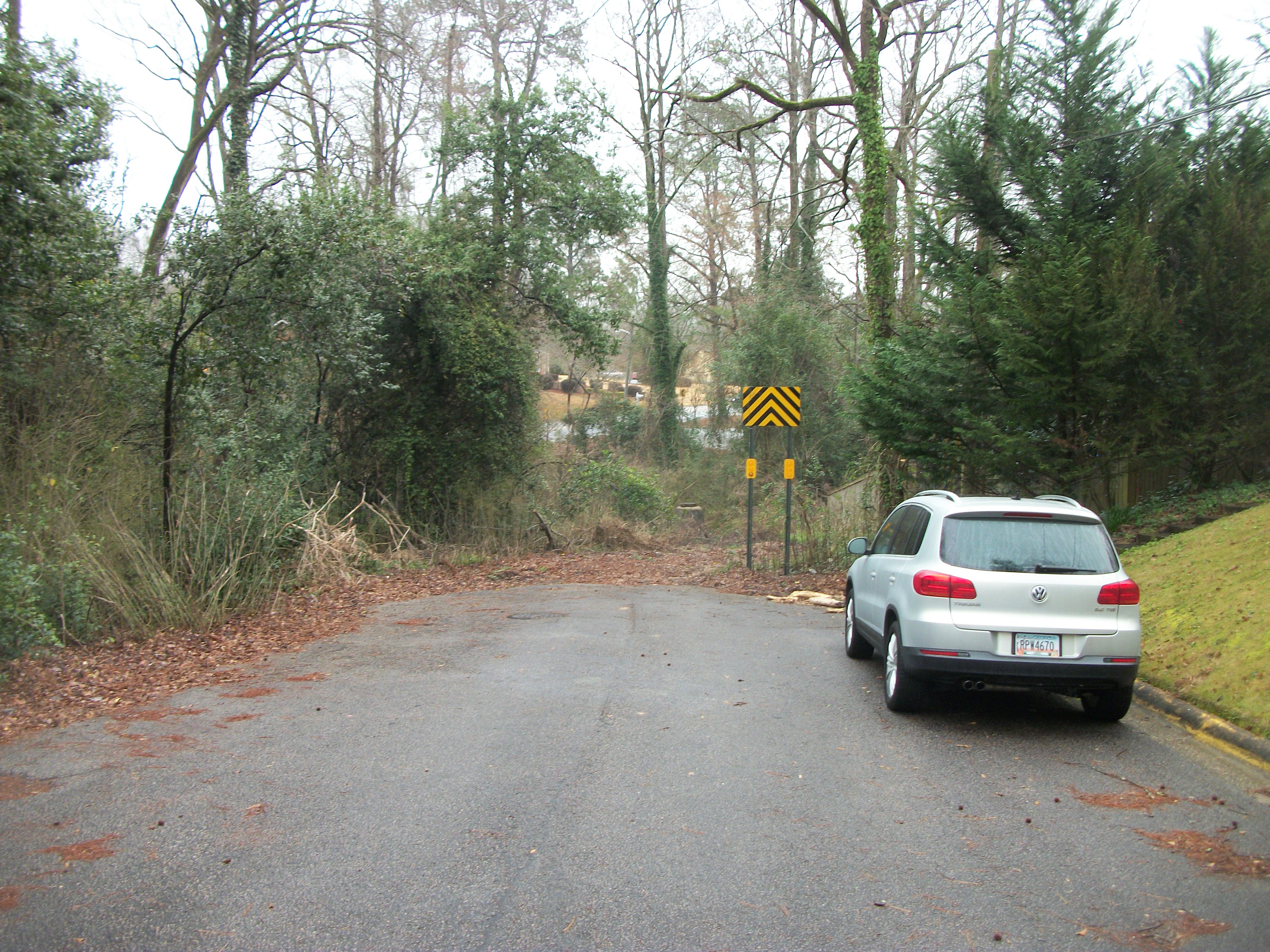
The road in the distant background is Chewacls Drive, certainly, but these days there is a sizable creek interrupting the road (I'm sure the creek has always been there, but a bridge used to span it?).
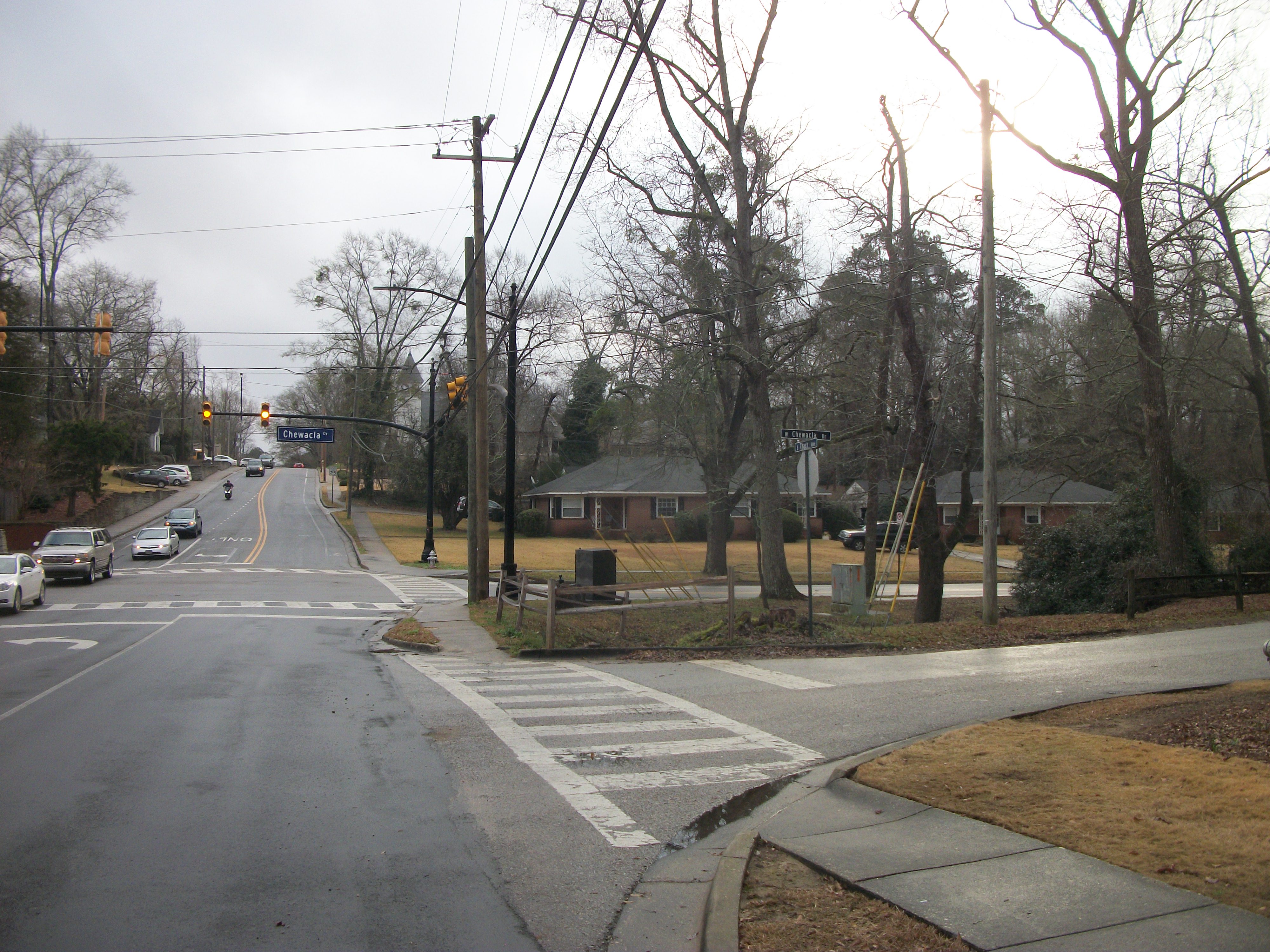
And what about "Pineview"? Well, presently it's named "West Chewacla Drive". I wonder why the name was changed? Here's the Thach Avenue, Chewacla, and West Chewacla intersection (you should be able to spot the street signs in the enlarged image):
And here is where West Chewacla deadends (or really just kind of peters out into wooded area:
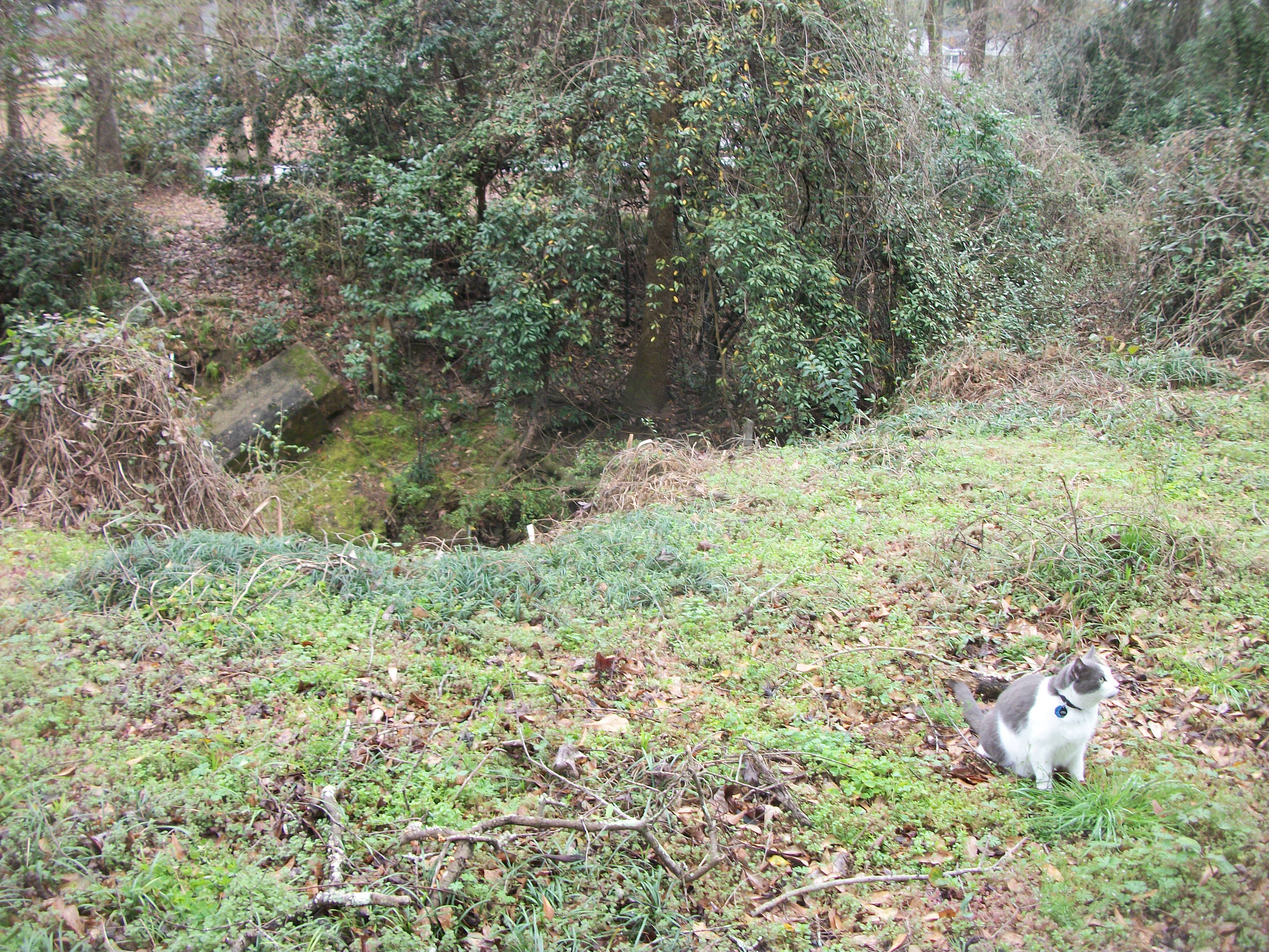
The whole area where all of these streets at one time intersected is now dominated by trees, brush, and the creek (I believe that is "Town Creek"). I lived on nearby Payne Street during my college years and I remember there being a foot path and (at least remnants of) a bridge over the creek, and I'm pretty sure the large concrete slab on the far bankside in this photo is all that's left of that structure:
Anyway, it is quite likely that much of this land is no longer property of the city of Auburn, but has been divvied up among adjacent landowners (much like what happened with Chisholm Drive). But, I'm not sure.
Whatever the case, this is just one minor change that has happened to the streets of Auburn. These days there are over 1000 names roads in the city, and at the rate Auburn is growing, who knows what it will look like in 75 more years...
Article Topics:
creeks
maps
roads_scholar
2025 [3]
2024 [5]
2023 [8]
2022 [4]
2021 [9]
2020 [13]
2019 [26]
· DECEMBER [1]
· OCTOBER [2]
· SEPTEMBER [2]
· AUGUST [3]
· JULY [2]
· JUNE [1]
· MAY [2]
· APRIL [2]
· MARCH [4]
· FEBRUARY [6]
| 17th | Exit 57 |
| 12th | 75 Years Later |
| 10th | Mystery on Chisholm Drive |
| 7th | Map of My Progress |
| 6th | The Dirt Road |
| 3rd | Saugahatchee Creek Bridge |
· JANUARY [1]
2018 [1]
2017 [1]
2016 [3]
2015 [1]
Topics
· animals
· auburn_university
· bridges
· camp_hill
· cemeteries
· chewacla_state_park
· churches
· creeks
· foraging
· libraries
· little_texas
· loachapoka
· maps
· milling_about
· notasulga
· puzzle_parties
· roads_scholar
· roxana
· ruins
· saugahatchee_road
· schools
· signposts
· springvilla
· stage_road
· trains
· tuskegee_national_forest
· underground
· unpaved_roads
· weather
Offbeat Auburn website, Copyright © 2015 - 2025, Eric Harshbarger